

 Português
  English
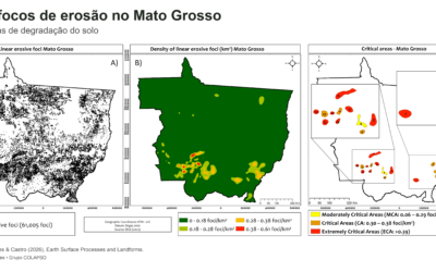
 A study published in Earth Surface Processes and Landforms mapped 61,005 linear water erosion foci in Mato Grosso, Brazil, and identified 15 critical areas. The results show how relief, soils, and mismatches between land use and agricultural land capability help explain the concentration of ravines and gullies, while providing insights for land-use planning and soil conservation.