
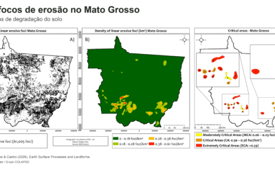
A study published in Earth Surface Processes and Landforms mapped 61,005 linear water erosion foci in Mato Grosso, Brazil, and identified 15 critical areas. The results show how relief, soils, and mismatches between land use and agricultural land capability help explain the concentration of ravines and gullies, while providing insights for land-use planning and soil conservation.
Processes and slope forms: e-book brings together studies on landforms and erosion from XV SINAGEO
An e-book edited by Grace Bungenstab Alves brings together studies on erosion, landforms, and slope dynamics across different regions of Brazil, highlighting the contribution of geomorphology to understanding landscapes in transformation.
Trapped in the forest: how soil shapes an unusual grassland in the Atlantic Rainforest
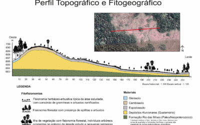
This study investigates the Campo do Veludo, an isolated grassland formation within the Atlantic Forest in southern São Paulo. By integrating soil, topographic, and vegetation data, the research shows that shallow, acidic, and poorly drained Spodosols shape the landscape structure and constrain forest expansion, resulting in a biogeographic enclave of exception. The authors also explore possible connections with muçununga formations, broadening the discussion on landscape diversity in humid tropical regions.
Toposequences: What Are We Really Studying?
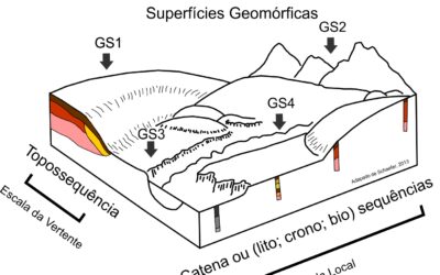
This post presents a critical review of the concept of toposequence in soil science. Based on a bibliometric analysis, the article identifies three main approaches: geomorphic surfaces, catena, and toposequence. It also proposes more precise criteria for the use of toposequence in pedogeomorphological studies.